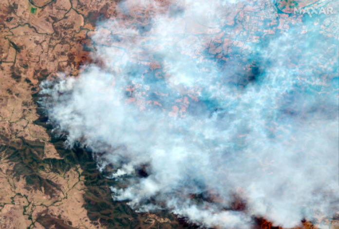
Record-breaking temperatures and months of severe drought have fueled a series of massive bushfires across Australia.
New South Wales has been the worst-hit state so far, with more than 12 million acres and 1,300 homes burned. Approximately 130 fires were burning throughout the state as of January 15, 2020. To put the New South Wales fire damage into perspective, about 2.2 million acres were lost in the 2019 Amazon fires and around 1.9 million acres were burned in the 2018 California wildfires.
As part of Open Data Program, MAXAR will publicly release data of the affected areas to support disaster response as it becomes available. Any imagery or data distributed through the Open Data Program is licensed under the Creative Commons Attribution Non-Commercial 4.0 license (CC BY-NC 4.0) (non-commercial use of the information). If commercial companies are interested in using the data distributed through the Open Data Program, it can be purchased by contacting MAXAR here.
Within the program “On duty for Planet”, whose partner is “LoReTT”, everyone can take part in various environmental projects or create their own.

Source: https://blog.maxar.com/open-data-program/2020/open-data-response-to-the-australian-wildfires