Products & Projects
«Lorett» products are included in the following catalogs and registries:
LORETT
Hardware & software complex for satellite monitoring
Developed with the grant support of the Innovation Promotion Fund

Educational laboratory complex for satellite monitoing "LoReTT" is designed to receive, demodulate, decode, record and process digital information, transmitted from spacecrafts in low Earth orbits via X-band radio channels with the range of demodulation speeds 0.2-100 Msps (with option up to 350 Msps).
The Complex provides a stable signal reception from the Terra, Aqua, Suomi NPP, JPSS satellites (in Direct Broadcast mode), and also from FengYun-3A/3B/3C, EROS B, Kanopus-V, and many others.
The Complex provides automatic data recoring on computer disk and receiving images from satellites in radius about 200 km from a point of Complex location.
"LoReTT" Сomplex can be introduced into educational and innovative projects in three directions:
- complex-constructor for engineering education;
- complex as a basis for an interdisciplinary project laboratory, basic tool for providing access to very high spatial resolution data in real time;
- complex as a tool for developing services and / or mobile applications. It can function for centers of collective use or through domestic and international hackathons.
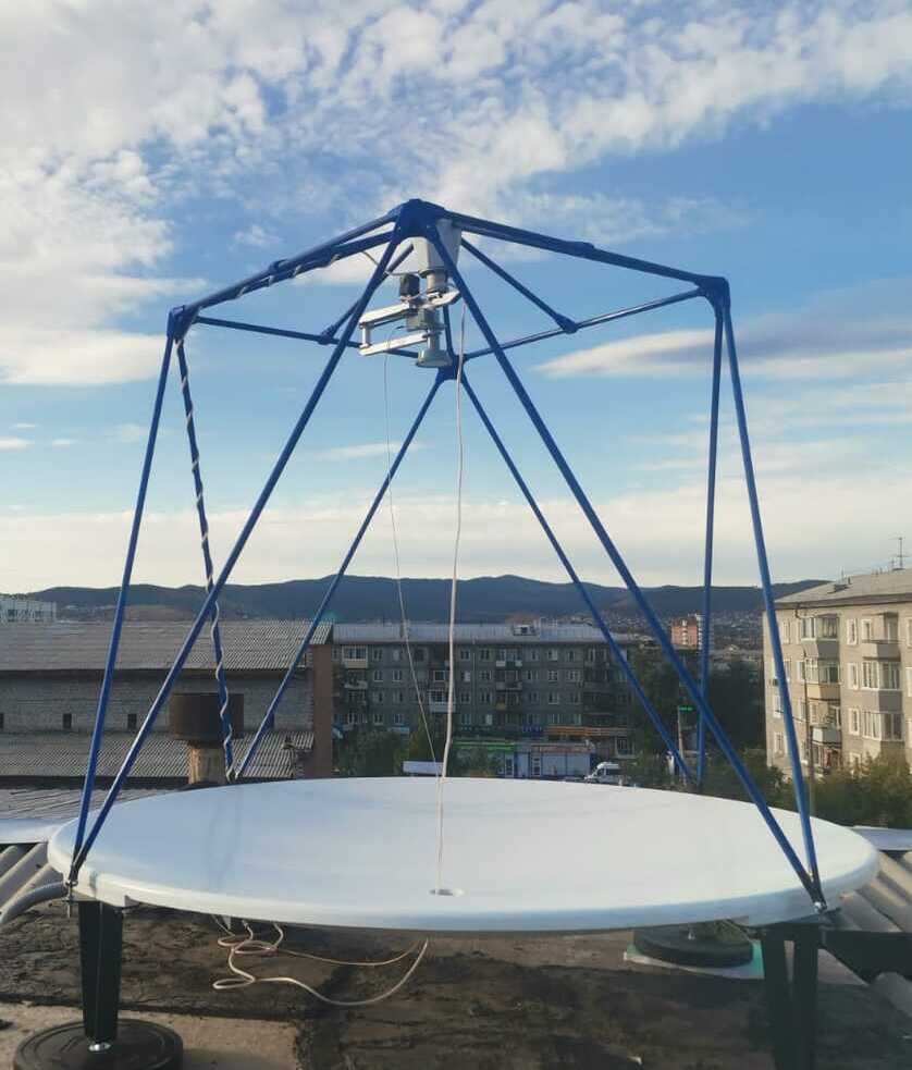
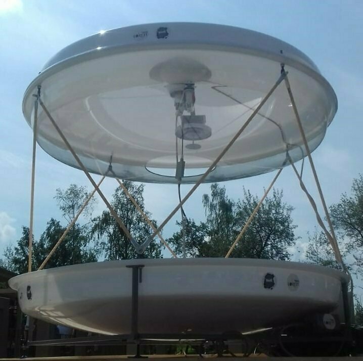
Silybum - X-band Ground Station for Remote Sensing of the Earth
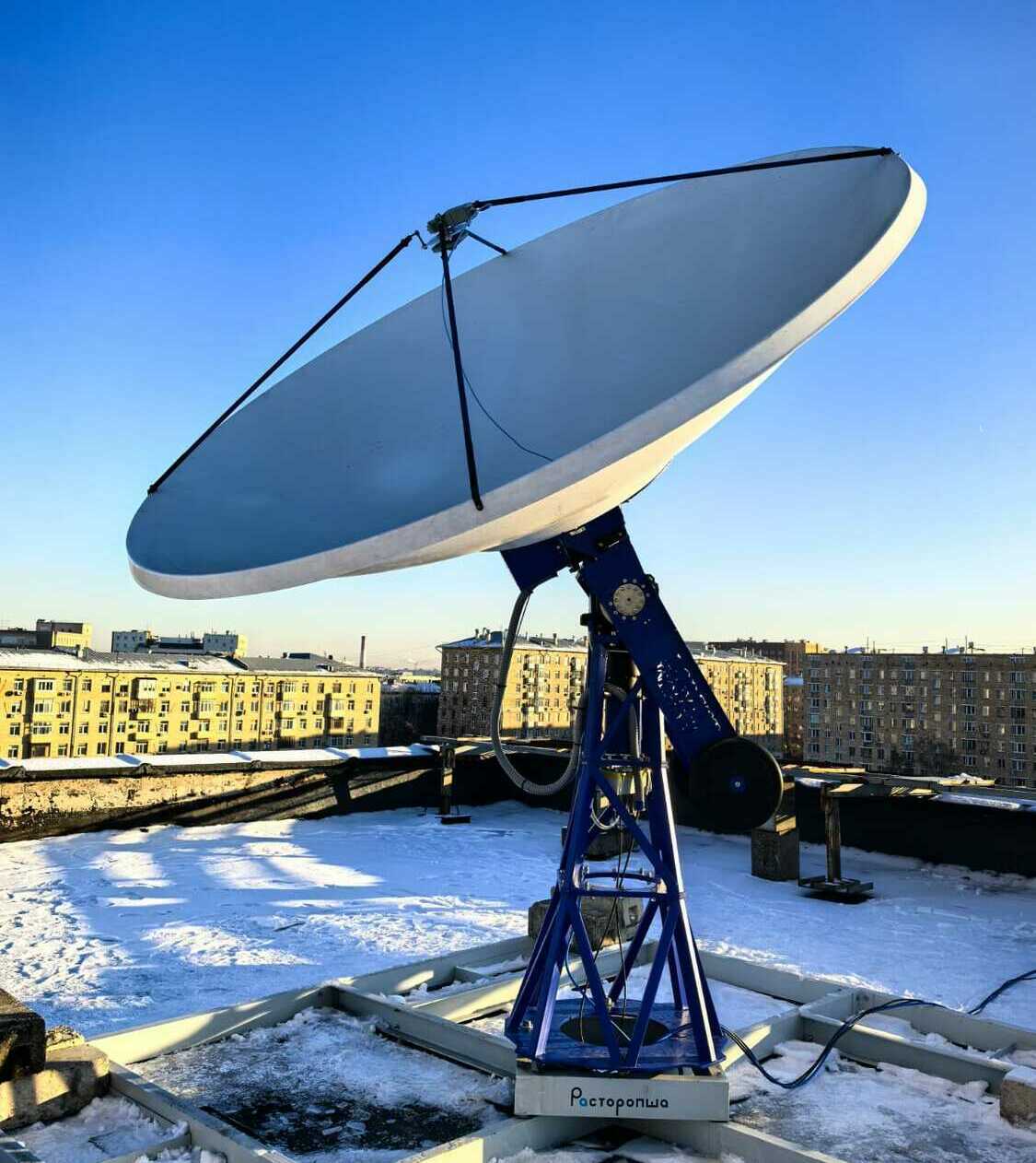
Professional receiving station "Silybum" is designed to receive and process digital information transmitted from Earth observation satellites located in low Earth orbits (LEO) via radio channels in the X-frequency range (7.8-8.4 GHz) in the signal rate range 0.1-100 Mbaud (option 0.2– 350 Mbaud).
The station provides stable reception of signals in the entire upper hemisphere (from 10 deg. elevation) without a "dead zone" in the near-zenith area from a wide range of satellites with optical and radar equipment providing images with a spatial resolution of up to 1 m and better.
The control software of the station performs a fully automated cycle of the station operation without operator participation.
Lenticularis
Laboratory Complex for Receiving Data from Meteo Satellites
Developed with the grant support of the Innovation Promotion Fund
Laboratory Complex for Receiving Data from Meteo Satellites "Lenticularis" is designed to receive, demodulate, decode, record and process digital information, transmitted from meteorological spacecrafts in low Earth orbits via L-band radio channels. It enbles to receive images from satellite series Meteor-M #2, NOAA, MetOp, FengYun-3.
The Complex provides receiving images from satellites in radius about 400 km from a point of Complex location and automatic data recording on computer disk.
"Lenticularis" can be implemented in educational and innovative projects in the following areas:
- construction complex for engineering education;
- complex as the basis of the design laboratory for the development of a number of competencies in the space industry and hydrometeorological support.
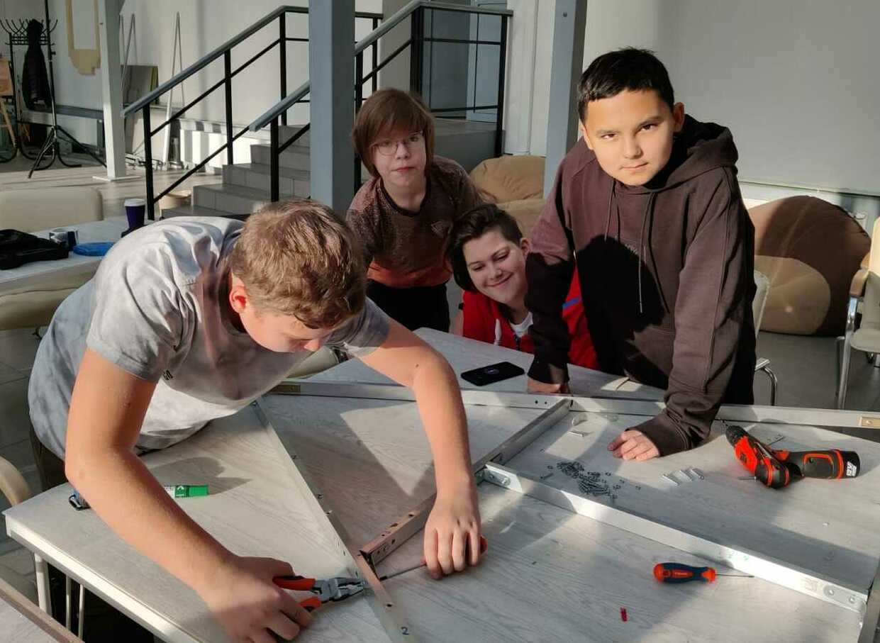
Engineering constructor Link2Space

Engineering constructor developed with the grant support of the Innovation Promotion Fund

Link2Space consists of components of an antenna system, an SDR receiver, a laptop, software for receiving and processing data.
Students independently assemble a kit and get a station (complex) for receiving satellite information, configure it and receive data from flying meteosatellites osuch as the Meteor-M No. 2, NOAA, MetOp via L-band radio channels in real time. Then the received images of the Earth from space are processed and analyzed.
Goals achieved when using the kit in the educational process:
- Creating a lively interest of students in scientific and technological activities;
- Attracting young people to the Russian space industry in terms of remote sensing of the Earth, which is one of the fundamental;
- Formation of children's interest in solving adult problems related to ecology and meteorology;
- Teaching children to work in a team, the ability to defend their interests and achieve their goals;
- Teaching children to work with new materials and equipment, work with electronics and learn the basics of programming.
As a result of the work, the task is solved on its own to assemble and configure an engineering kit, get a workable satellite image reception station, take an image from weather satellites to an antenna assembled on its own.
Engineering constructor Copter4Space
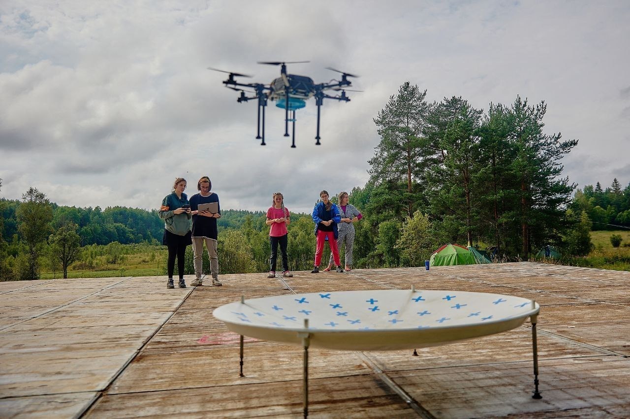
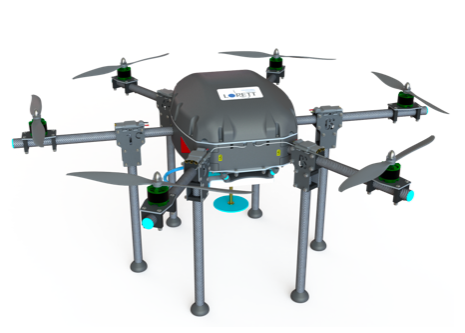
Copter4Space consists of a copter building kit, radio electronic units and all necessary components for installing an irradiator for receiving satellite images on a quadrocopter, a parabolic mirror with a marked airfield, a laptop, software for receiving and processing data.
Students independently assemble a drone, install an irradiator with the necessary radio engineering elements, assemble and adjust the airfield and reflector, configure it and receive space images of the Earth from flying meteosatellites such as Meteor-M No. 2, NOAA, MetOp on radio channels of the L-frequency range in real time with the possibility of their subsequent thematic processing and use in a wide range of scientific and practical tasks.
The building kit can be included in the infrastructure that provides project activities and programs of basic and additional education.
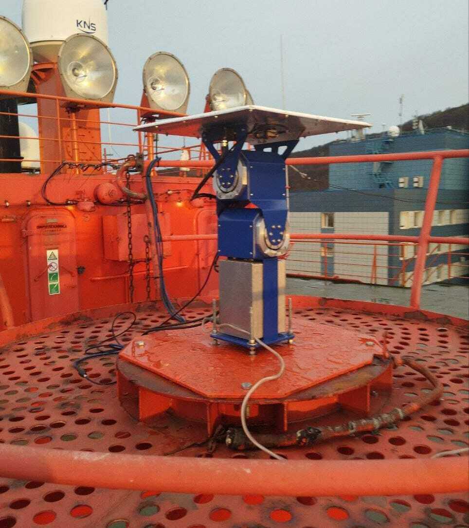
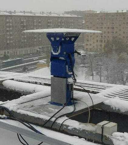
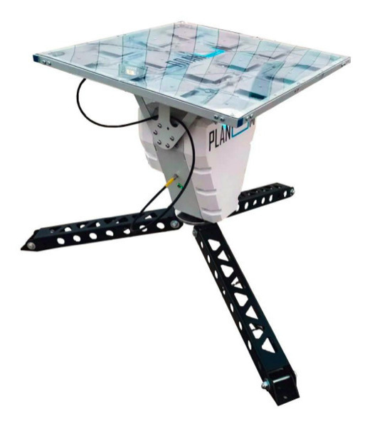
Hardware & software complex Planum
Developed with the grant support of the Innovation Promotion Fund

The planar station for receiving space information for mobile platforms is designed to receive and process digital information transmitted from meteorological satellites such as the Meteor-M No. 2, NOAA, MetOp via L-band radio channels.
To receive radio signals from artificial Earth satellites (ISS), an antenna is used, which is a flat phased array. The station allows you to receive information from the satellite both in a stationary state and during the movement of a mobile platform (ships, railway platforms, cars, etc.). The hardware and software system of roll compensation and dynamic orientation to the cardinal points allows you not to use the traditional gyro platform in such cases.
The control software of the station performs a fully automated cycle of its operation without operator intervention.
Engineering constructor Planum
"Planum" engineering constructor (EC) is designed to receive and process digital information transmitted from meteorological satellites such as the Meteor-M No. 2, NOAA, MetOp via L-band radio channels.
To receive radio signals from Earth observation satellites, a flat phased array antenna is used.
"Planum" can operate 24 hours on battery power without connecting a power cord.
"Planum" engineering constructor contents:
- antenna system;
- LNA (low noise amplifier);
- cable set;
- laptop for receiving and processing information;
- software for data receiving and processing;
- set of documentation.
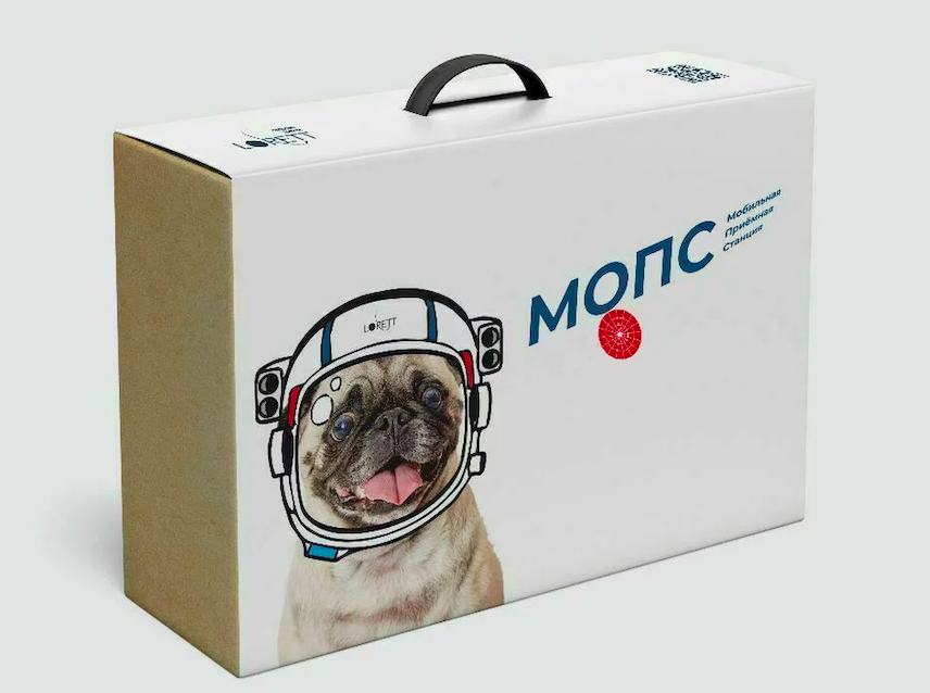
MObile Portable Station (MOPS)
Principle of work with MOPS:
- Assemble a kit and get a station (complex) for receiving satellite information.
- Configure it and receive data from flying meteorological satellites such as the Meteor-M No. 2, NOAA, MetOp via L-band radio channels in real time mode.
- Process and analyse the received images of the Earth from space.
Key features of MOPS:
- It is possible to manufacture all structural parts if the necessary equipment is available and the recommendations of the manual for the designer are observed.
- Everything, except for the manipulator, can be assembled by schoolchildren at technology lessons or as part of extracurricular activities, project activities, vacation trainings etc.
- Schoolchildren assemble the structure and parts, and also make a reflector. It is possible to manufacture parts according to drawings.
- The weight of the constructor is 5 kg (excluding the set of cables).
- The packaging is compact and easy to transport.
- MOPS is designed for operational reception or short-term duty.
Educational Game "How to Catch a Satellite" using the "LEX" constructor (6+)
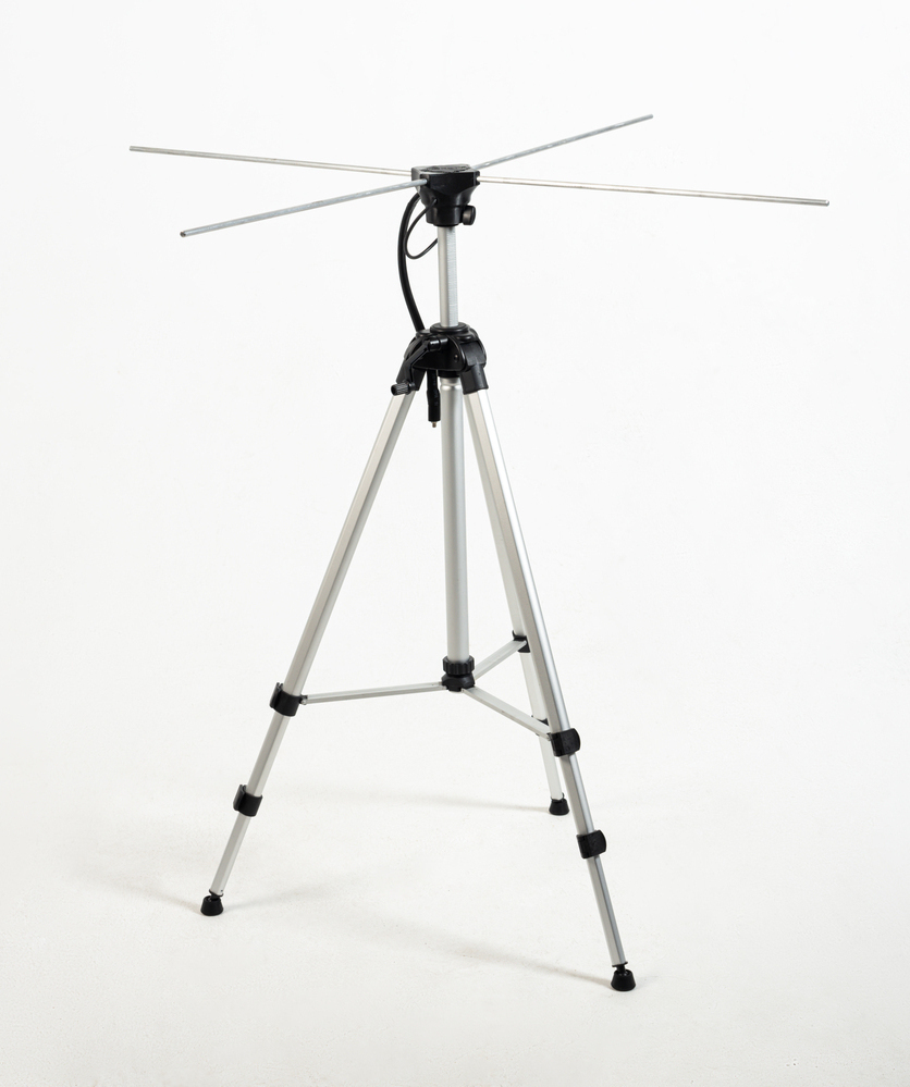
The educational game "How to Catch a Satellite" is designed to promote space technologies, satellite image reception and processing, satellite meteorology, and weather forecasting technologies using the "LEX" constructor. It also introduces players to working with geographic information systems (GIS) and spatial data.
The "LEX" constructor is a kit for assembling a turnstile antenna used to receive and process data from Meteor-M №2 and NOAA meteorological satellites on VHF frequencies (137 MHz). The kit includes the antenna itself and a tripod. The turnstile antenna (from French tourniquet — turnstile, rotating crossbar) consists of horizontally symmetrical half-wave dipoles, crossed in pairs at right angles and mounted on a common vertical mast.
Target audience: older preschoolers, elementary, and middle school students.
Goals Achieved Through the Use of the Constructor in the Learning Process:
- Fostering a genuine interest in scientific and technological activities among students.
- Engaging youth in the Russian space industry, particularly in remote sensing of the Earth (RSE), which is one of its fundamental areas.
- Developing children's interest in solving real-world challenges related to ecology and meteorology.
- Teaching teamwork skills, the ability to advocate for their ideas, and achieve set goals.
- Introducing students to new materials and equipment, enhancing their technical proficiency.
The game can be used:
- In environmental studies classes
- In geography lessons to reinforce topics such as "Continents, Oceans, Peoples, and Countries," "Geography of Russia," and "Regional Geography."
- In computer science classes when studying "Vector and Raster Graphics," "File Cataloging," "Application Software," and "Data Processing."
- During extracurricular activities, including workshops, masterclasses, and school-wide events.
- For family leisure and educational entertainment.
Contents:
- "LEX" Constructor – 1 unit
- Roll-up banner (60 cm × 180 cm) with a quiz – 1 unit
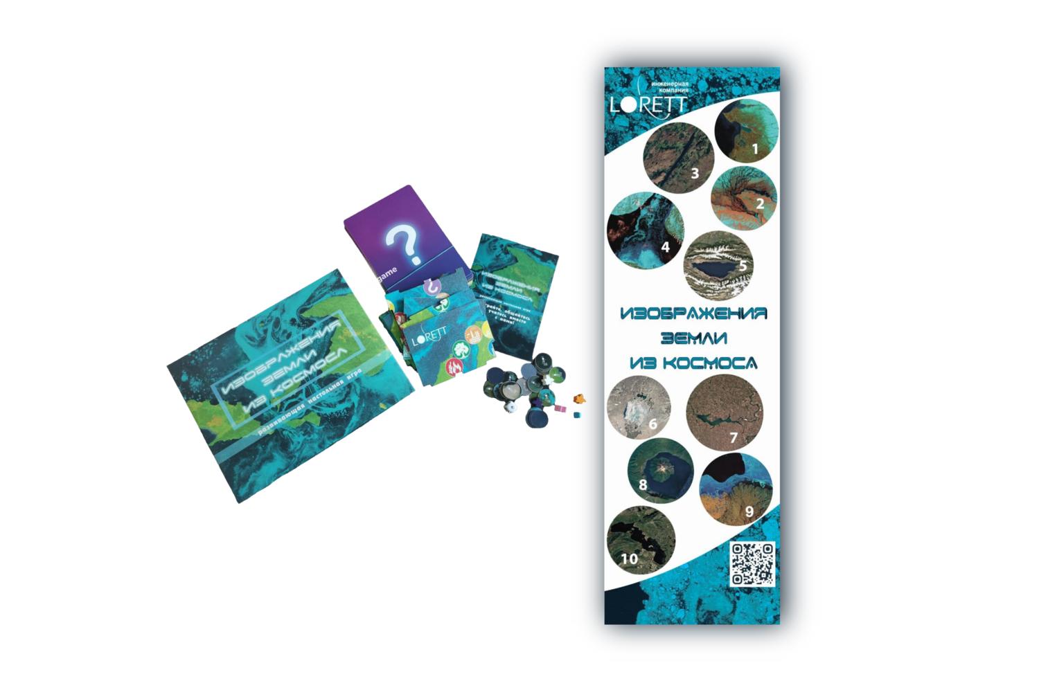
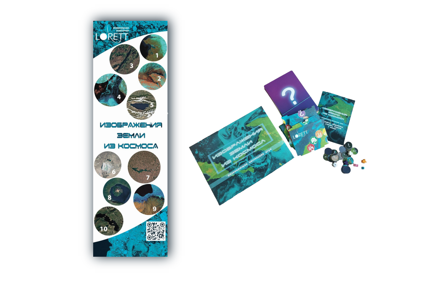
- Board game "Images of the Earth from Space" – 2 units
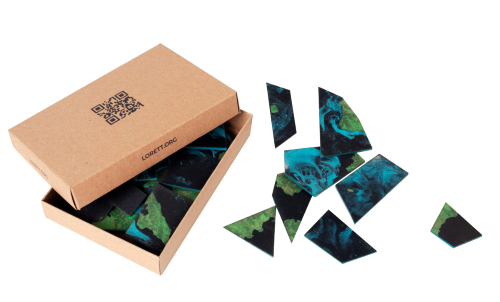
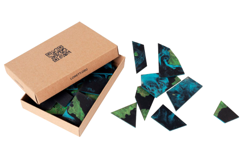
- Large puzzles – 2 units
- Laptop – 1 unit (not included in the kit!)
Educational game "How to Catch a Satellite" using the "Planum" engineering constructor with manual control (6+)
The educational game "How to Catch a Satellite" is aimed at promoting space technologies, satellite image reception and processing technologies, working with geographic information systems (GIS) and spatial data, satellite meteorology, and weather forecasting technologies using the "Planum" engineering constructor with manual control.
The "Planum" engineering constructor with manual control consists of a set of components for assembling a patch antenna and software for data reception and processing. Students independently assemble the constructor, configure it, and receive data from passing meteorological satellites such as Meteor-M №2, NOAA, and Metop via L-band radio frequencies in real-time. As a result of the assembly and configuration, Earth images from space are received manually, with the possibility of subsequent thematic processing.
Target audience: older preschoolers, elementary, and middle school students.
Goals achieved through the use of the constructor in the learning process:
- Fostering a genuine interest in scientific and technological activities among students.
- Engaging youth in the Russian space industry, particularly in remote sensing of the Earth, which is one of its foundational areas.
- Developing children's interest in solving real-world challenges related to ecology and meteorology.
- Teaching teamwork skills, the ability to advocate for their ideas, and achieve set goals.
- Introducing students to new materials and equipment, enhancing their technical proficiency.
The game can be used:
- In geography lessons to reinforce topics such as "Continents, Oceans, Peoples, and Countries," "Geography of Russia," and "Regional Geography."
- In computer science lessons when studying "Vector and Raster Graphics," "File Cataloging," "Application Software," and "Data Processing."
- In technology lessons.
- As part of extracurricular activities, workshops, and sections during school-wide events.
The game can be conducted in both group and individual formats.
Contents:
- "Planum" engineering constructor with manual control – 1 unit
- Roll-up banner (60 cm × 180 cm) with a quiz – 1 unit
- Board game "Images of the Earth from Space" – 2 units
- Large puzzles – 2 units
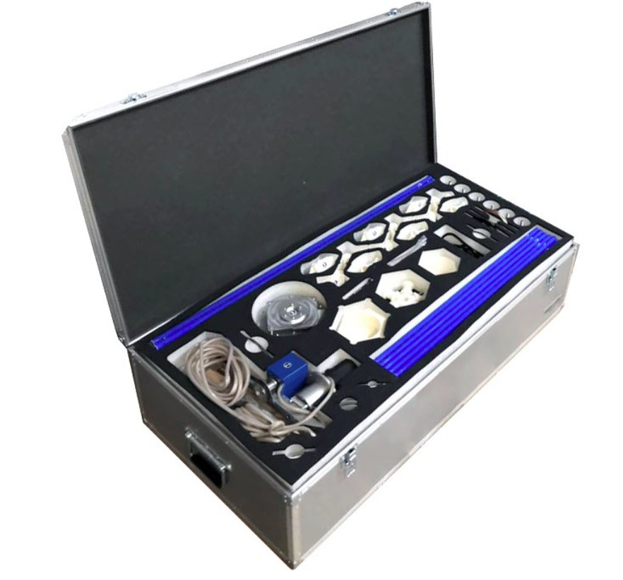
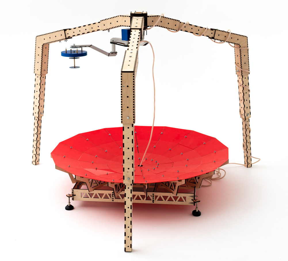
Measuring stand for testing sheet materials for radio transparency and radio transmission
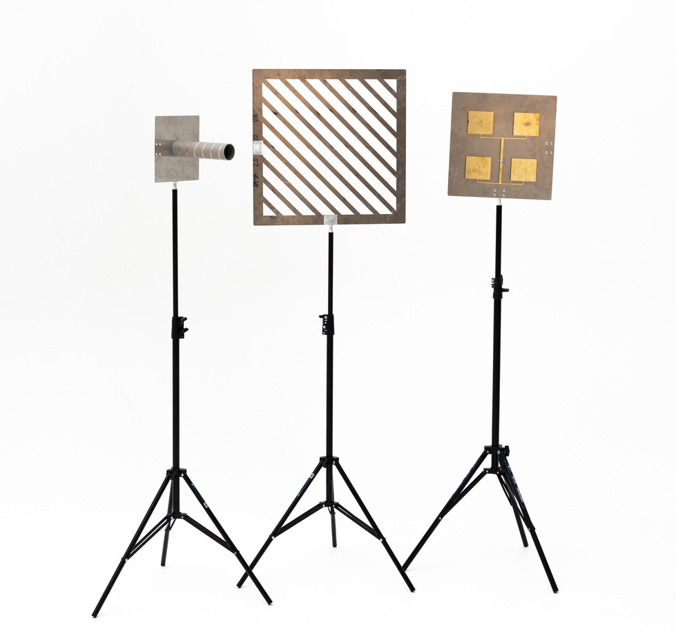

The purpose of the stand is to measure the antenna pattern, study the polarization properties of the electromagnetic field, study the reflective and transmissive properties of sheet materials of various types. Designed to measure the characteristics of antenna systems in the frequency range 50 kHz - 6.3 GHz.
Stand includes:
- Linear polarization antenna (2 pcs.)
- Right circular polarization antenna (2 pcs.)
- Left circular polarization antenna (2 pcs.)
- Coaxial cable (2 pcs.)
- LiteVNA-64 Compact Vector Network Analyzer (1 pc.)
- Photo tripod (3 pcs.)
- Set of sheet material samples (3-4 pcs.)
- Antenna mounts (8 pcs.)
- Diffraction grating (2 pcs., straight and oblique)
- Fasteners (nuts and bolts M4, 4 pcs. per fastener)
- Tools (crosshead screwdriver, wrench 7/8)
- Guidelines
The stand represents a single technological chain, no additional adaptation is required to coordinate the devices. Supplied with a user manual in electronic form.
Educational projects
- All-Russian competition "Operational satellite monitoring";
- Regional space programs for children;
- Engineering circles and project activities;
- Advanced training courses for mentors and teachers;
- Lectures and trainings for children and adults;
- Scientific and practical intensive courses;
- Consultations;
- and much more!
You can get acquainted with the list of materials on remote sensing recommended for study in the TRAINING section.
MODIS Real Time
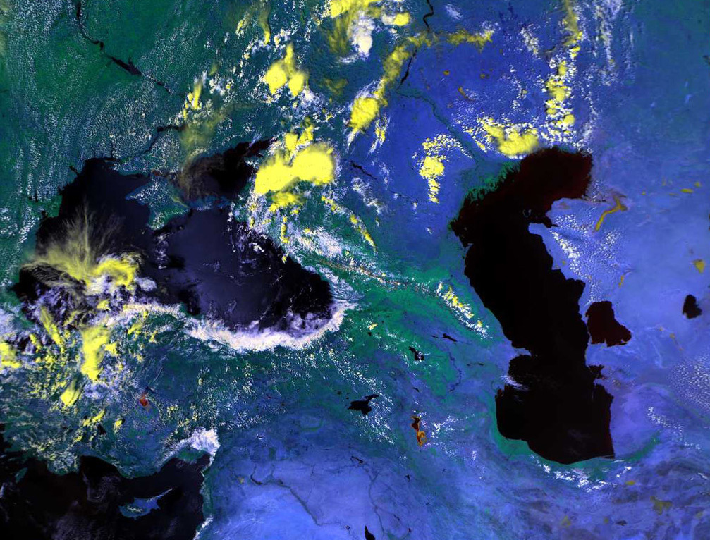
Providing meteorological data on cloudiness through the MODIS/Terra and Aqua data service in real time
"LoReTT" LLC provides users with initial data of space imagery and information products, obtained from MODIS radiometer data (Terra and Aqua spacecrafts), using standard algorithms for coordinated areas of interest:
- cloud mask (MOD35);
- data on the temperature of the upper edge of the cloud cover (MOD06CT).
"LoReT" LLC provides access to online data in 24/7 mode by an agreed login and password using the FTP protocol. Information is provided to users in HDF4 file format. The contents of the fields, their encoding and formatting within the HDF are described in the NASA documentation for respective products. "LoReTT" LLC provides users with a description of the format of the products. Approbation of the method and verification of the results were carried out jointly with the Institute of Radar Meteorology (IRAM), St. Petersburg, Russia.
Software

MeteoLenta®
A software package for processing satellite digital meteorological information on the topics of hydrometeorological monitoring and environmental monitoring.
